Photo Credit: WRRB.
Monitoring Ekwǫ̀ (Caribou) Where It Counts: 2025 Ground Survey of the Kǫk’èetı Ekwǫ̀ (Bathurst Caribou) and Sahtì Ekwǫ̀ (Bluenose-East Caribou)
In June, WRRB Conservation Biologist Amanda Weltman contributed to the 2025 ground survey of the Kǫk’èetı Ekwǫ̀ and Sahtì Ekwǫ̀ herds, focusing on the calving grounds near Kugluktuk, Nunavut.
“Getting the opportunity to do this survey is a once-in-a-lifetime experience. Knowing how important caribou are to people of the North and Indigenous communities, it’s very special to be able to see a small window of this important time of their lives,” Amanda shared. “It’s like seeing a baby be born – these calves are only a couple days old, it’s very special.”
The dynamic nature of these herds keeps the work fresh – and sometimes unpredictable.
The 2025 survey aimed to estimate the population size of Kǫk’èetı Ekwǫ̀ and Sahtì Ekwǫ̀ herds, with a focus is on counting females that were calving. “This kind of survey happen every three years,” Amanda explained, “and June is the best time to do it because the caribou are stationary on the calving grounds for about one to two weeks – they’re not moving around much, which makes it easier to count them.” Each herd typically calves in specific areas of its range, so the team can identify which herd they’re observing based on where they’re flying. “If we’re over one area, we know we’re seeing the Bathurst herd. In another area, it’s Bluenose-East,” she said. Some herds are declining throughout the North – gathering information helps researchers monitor population health, track herd movement, and inform management decisions that respect both ecological needs and Indigenous knowledge.
But conducting surveys in the Arctic isn’t always straightforward. The remoteness of the landscape and unpredictable weather make this work both challenging and rewarding.
The process begins with reconnaissance flights. “The survey starts with flights for each herd,” Amanda explained. “GNWT has collars on caribou from both herds, and we use that data to get an idea of when they slow down — because that tells us they’ve had their babies — and where they are on the land.”
Since it’s not possible to collar every animal, these flights help confirm where the main group is located and how far the herd is spread out. “We fly over the collared areas and then do a buffer around the edge to make sure we didn’t miss any caribou,” Amanda said. “It’s not necessarily for data entry — it’s so we know when to go back for the real survey and where to fly. We can go away and come back a couple days later, and they’ll still be there.”
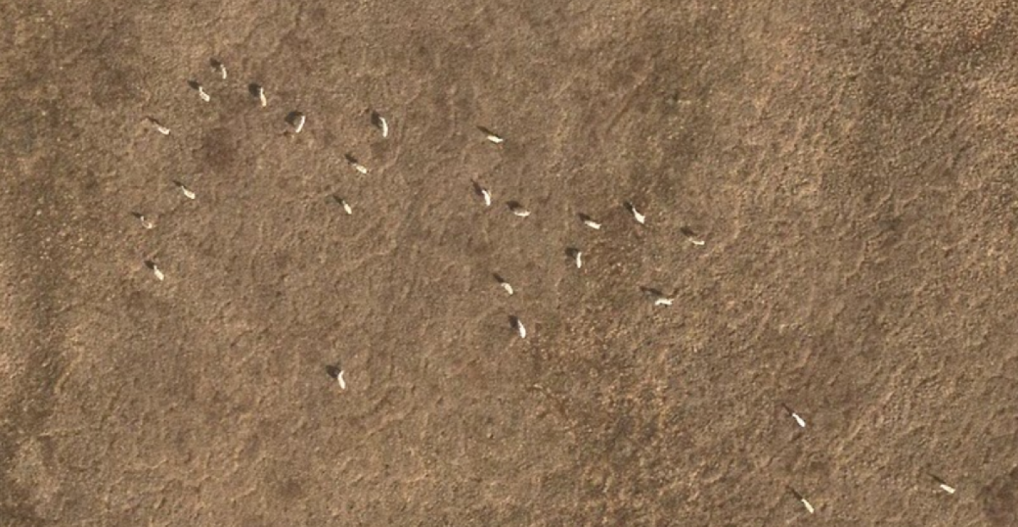
After recon, the actual survey takes place. “There are two components,” she said. “Two observers sit on either side of the plane with a recorder behind them. It’s basically the same as recon, but this time it’s the actual survey.” These planes fly along the outer edges of the herd, where there are fewer animals, to reduce the chance of human counting errors.
“For the core, where there’s a high density of caribou, a different plane goes in — a photo survey plane,” Amanda added. “It has a camera on the bottom and takes pictures over the highest density of the core. This allows us to get a better estimate of how many caribou are at the center of their distribution, because there are too many for humans to count flying by.”
Ground-based observation is the final step. Biologists travel by helicopter to selected calving grounds and observe from the air and ground. “We observe how many cows have calves and get a cow-to-calf ratio,” Amanda said. “If a herd is doing well, they’ll have a high ratio — like 25 cows to 25 calves. That means every cow had a calf. We want high numbers because that means the ladies are doing well.”
Each method plays a different role. “Aerial surveys are just numbers — mostly cows, not calves, because they blend in,” she said. “Ground work gives us information about their calving success. One tells us how many, the other tells us how successful.”
This survey is one part of a broader collaborative effort that brings together government agencies, Indigenous organizations, and local communities – including the WRRB, the Tłı̨chǫ Government, and the Government of the Northwest Territories.
“It’s important we work together,” Amanda said. “That will contribute to the herds’ management, but also future management decisions once we get results.”
Insights from community members and long-term knowledge holders are essential to understanding the Kǫk’èetı Ekwǫ̀ and Sahtì Ekwǫ̀ behavior and responding to the herds’ changing needs.
With the Kǫk’èetı Ekwǫ̀ herd declining and the Sahtì Ekwǫ̀ showing signs of recovery, this kind of work is essential. The surveys add to what we know, not just through numbers, but through the shared knowledge of researchers, communities, and knowledge holders on the ground. Each flight, photo, and observation on the ground builds a clearer picture of how the herds are doing, and how we can support them moving forward.
Photo Credit: WRRB.