Barren-ground caribou including Bathurst caribou are part of an environment that is constantly changing—local weather conditions, a fluctuating climate, predation rates, and insect abundance, for example, can all vary from one year to the next. These and other factors all likely influence variations seen in caribou including herd movements, health, survival rate, productivity or abundance. Warmer summer temperatures can mean a greater number of insects that harass the caribou, preventing it from feeding. Or a winter with deep, hard snow may affect caribou’s feeding strategies, making it harder for the caribou to find the lichen that is its main source of nutrition in winter.
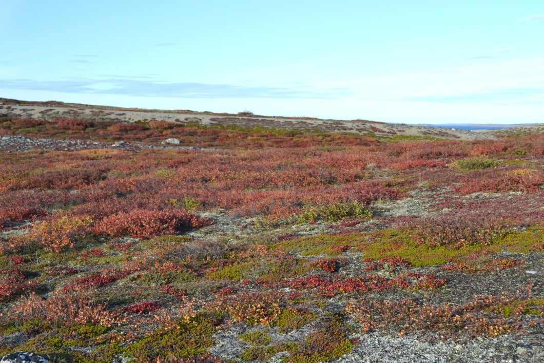
How nutritious and available caribou food is, is another possible factor influencing caribou. In summer, Barren-ground caribou feed on sedges, grasses, mosses, lichens, the leaves of dwarf birch and willows, and small shrubs. How abundant are the plants that caribou need to build their fat reserves to survive the winter, or in the case of cows, become pregnant? How much lichen is there for caribou on their winter ranges in the boreal forest or on their caribou grounds? Wenjun Chen from the Canada Centre for Remote Sensing, Natural Resources Canada is the lead on a study that’s looking at changes in vegetation and snow cover over the Bathurst caribou’s range, using satellite remote sensing and community-based field monitoring.
Satellite remote sensing can assist with monitoring the habitat the Bathurst herd uses year-round. It is being used to determine the percent cover of lichen in the calving ground and the availability of lichen in the winter range—and how much vegetation is available to caribou on the calving grounds and on the summer range. It is also being used to monitor changes in snow cover along the caribou’s spring migratory route.
This year, the project focused on community-based monitoring, with two community members from Wek’weeti doing vegetation monitoring at three sites near Wekweètì from June to October. Three different vegetation types were monitored: lichen tundra, sedge wetland, and shrubs. Similar vegetation monitoring was done at three sites near Daring Lake by a Carleton University professor and her students.
An important objective of the project is to assess the possible impacts of habitat changes to the Bathurst caribou’s productivity and abundance. Look for more information on this study in a future issue.
Fact Box:
Wenjun Chen, with the Canada Centre for Remote Sensing, Natural Resources Canada, is the project lead. Project collaborators include:
- Environment and Natural Resources, GNWT
- Culture and Lands Protection Department, Tłı̨chǫ Government
- WRRB
- CARMA (CircumArctic Rangifer Monitoring and Assessment)
- NRCan
- Carleton University, Department of Geography and Environmental Studies